
THE VALE council has agreed to consult on plans for potential walking and cycling routes.
Members of the newly formed cabinet, which met for the first time on Monday, June 5, agreed to put their plans out for a 12 week public consultation process which will start on June 15.
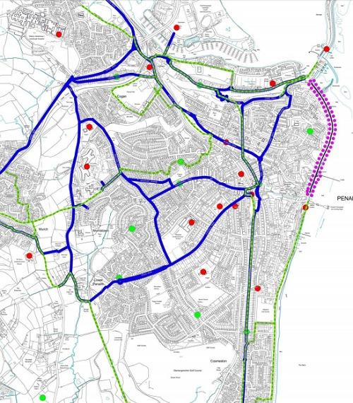
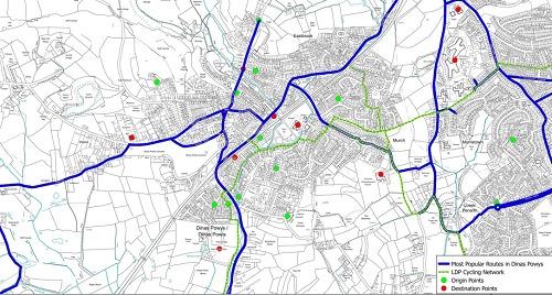
Proposed maps have been drawn up for Penarth and Dinas Powys which are among the places identified in the active travel area.
In September 2014, the Welsh Government introduced the Active Travel (Wales) Act 2013 which makes it a legal requirement for local authorities in Wales to map and plan suitable routes for active travel such as walking and cycling.
The act requires two maps to be produced, the existing route maps and the integrated network map.
The existing route maps show the routes within the designated areas that have been deemed suitable and appropriate for making active travel journeys.
Funding to create and consult on the maps has been provided by the Welsh Government to the sum of £14,000 in 2015/16, £9,000 in 2016/17 and £9,000 in 2017 /18 as part of the Local Transport Fund.
The existing route maps are intended to inform the public of the safe and suitable routes for active travel.
They include routes that are currently used but may not meet the standard required of active travel routes or they could be routes that do not currently exist but that have been identified as suitable.
To view the maps for Penarth and Dinas Powys, visit https://goo.gl/zSKOJ3


Comments: Our rules
We want our comments to be a lively and valuable part of our community - a place where readers can debate and engage with the most important local issues. The ability to comment on our stories is a privilege, not a right, however, and that privilege may be withdrawn if it is abused or misused.
Please report any comments that break our rules.
Read the rules here